
The Historical Legacy of the Laguna Wilderness
Originally the Laguna Wilderness was home to Native Americans. Remnants of their cultures are scattered in and around Laguna Beach. The archeology of Orange County is meager. There are no great burial sites, but Morris-Smith (1979) has studied a burial ground in a cave in Sycamore Hills and identified many sites elsewhere. Two early Native American cultures are known, the Ute-Aztekas and the Shoshones, who occupied the area around the canyon lakes known as the Lagonas (apparently a distortion of the Spanish “La Cañada de las Lagunas”). In 1904 the area became known as Laguna Beach (Luna-Seeden, 1985: 3–4). Most references to Native Americans in the area today are identified with the Acachemem Indians and the Juaneño Band of Mission Indians (see photos and references in Estes and Slayton, 1990: 41–44 and 141–144, and accounts drawn from the priests John O’Sullivan and Geronimo Boscana in Meadows, 1966). Native Americans undoubtedly lived in caves, but generally they resided in villages of a few dozen to several hundred persons in houses of brush or tules lashed to a frame of poles. Signs of Indian occupation are common; there is soil flecked with charcoal on every ridge that ends at the sea between Corona del Mar and Dana Point. Some sites are believed to have been occupied for thousands of years. Although water was scarce, seed-bearing plants were abundant during the summer and fall, and the rocky shores and bays were full of sea life. Acorns provided another source of nourishment. The Native Americans’ languages, of Shoshonean origin, differed within small areas; for example, the Indians south of Aliso Creek had difficulty communicating with those north of the creek (Meadows, 1966: 28). In 1769 the Franciscan priest Juan Crespi, traveling with the Spanish governor, Gaspar de Portolá, and his soldiers, described Aliso Canyon as follows: “All the valleys and hills on both sides are of pure earth, well-covered with grass, and without a single stone. So we went on over very open country, with hills and broad mesas, ascending and descending through three or four little valleys of good soil well-grown with alders” (Meadows, 1966: 41). The Indians, whom Crespi found passive and friendly, soon became dependent on the Franciscan mission established November 1, 1776, as San Juan Capistrano, the first permanent Spanish settlement in Orange County.
In the nineteenth century much of the Laguna Wilderness became part of Spanish (up to 1822) or Mexican (from 1822 until 1848) land grants. To the north of Laguna Beach the 48,803-acre Rancho San Joaquín (later the Irvine Ranch) was created by two grants (April 13, 1837, and May 13, 1842) to José Sepúlveda. The first, known as “Swamp of the Frogs,” extended from above Newport Bay to Red Hill in Tustin, and the second, La Bolsa de San Joaquín, included what was then Laguna Canyon Creek. To the south the 13,316-acre Rancho Niguel (later the Moulton Ranch) was granted to Juan Ávila and his sister Concepción (June 21, 1842) and included land on both sides of Aliso Creek between Laguna Canyon and the mission lands of San Juan Capistrano. José Serrano, who in 1842 was granted lands where present-day Laguna Hills is located and established the Rancho Cañada de los Alisos, had been grazing his cattle in Aliso Canyon since 1836 (Meadows, 1966: 100–102). The land between the San Joaquín and Niguel ranches was settled by the Mexicans José Antonio María Acuña and Ysidoro Olivares before California was relinquished by Mexico in 1848. Olivares homesteaded 50 acres in what today is Laguna Woods and worked at the nearby Rawson Ranch. On his death at the age of a hundred and seven in 1933 the land was inherited by the Daguerre family, apparently descendents of Louis Jacques-Mandé Daguerre, the French inventor of the daguerreotype (Ramsey and Ramsey, 1976: 4–5). At one time Jean-Pierre Daguerre owned a third interest in the Moulton Ranch (Viebeck, 1995: 8). From the 1850s on, cattle roamed the area now known as Laguna Beach, although the drought of 1862–1864 brought devastation: “For years dry bones lay around the dried up water holes where the cattle had come to drink and where they had died by the thousands piling on top of each other. For years the dry bones were ground up for fertilizer” (Ramsey and Ramsey, 1976: 100).
James Irvine, an Irishman who had come to San Francisco in the mid-nineteenth century and made his fortune as a merchant in the California gold rush, purchased the Rancho San Joaquín from José Sepúlveda in 1864 and the Rancho Lomas de Santiago from William Wolfskill in 1866. In 1876 he formed the Irvine Ranch. With his death in 1886, the ranch passed to his son, James Irvine II, who assumed control in 1893 at the age of twenty-five. He moved his family from San Francisco after the earthquake in 1906 (Irvine Ranch, [2001]) and shifted from ranching to agriculture, replacing cattle and sheep with oranges and vegetables.
After California became independent, Laguna Beach attracted many settlers. The first, Eugene Salter, homesteaded 152 acres in Aliso Canyon, and in 1871 his abandoned cabin was occupied by George Thurston and his family. They remained for fifty years on what is now the golf course and Aliso Canyon Lodge, located along Aliso Creek just before it reaches the sea (Ramsey and Ramsey, 1976: 44). William and Nathanial Brooks settled in 1876 at Arch Beach. In 1878 John Damron homesteaded the flat land above Arch Beach and part of Temple Hills. Henry Rogers homesteaded an area from Temple Hills to Bluebird Canyon. Two years later Frank Goff settled on land north of Aliso Canyon, and a few years later Harvey L. Hemenway homesteaded 500 acres in Laguna Canyon (Jones, 1997: 356–361). Later the Damron property (now downtown Laguna Beach) was sold to George Rogers, whose home stood on the site of city hall in front of the enormous pepper tree he planted (Viebeck, 1995: 7). Adjacent to his home, Rogers founded the first school. In 1888 a new school was built by Mormons in Laguna Canyon near the intersection of El Toro Road and Laguna Canyon Road, and in 1893 it was moved to Canyon Acres and later to Legion Street (Turnbull, 1988: 124). The site later became the home and studio of the renowned photographer William Mortensen.
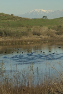
Laguna Canyon provided a trail initially used by Native Americans, and later it was occupied by settlers and thieves. It was to become the southeast line of the San Joaquín Grant and the Irvine Ranch. William Brooks facilitated travel through the canyon with the first stage line for a handful of residents and visitors, having successfully sued the Irvine Ranch, which in 1886 had closed off the old trail that ran through Laguna Canyon (Blacketer, 2001). Water was available there for the cattle of the Irvine and Moulton ranches (Ramsey and Ramsey, 1976: 44). In 1907 Frank Richey, a beekeeper, drilled a well for his home in Laguna Canyon, and until 1945 visitors to Laguna frequently stopped there for water. In 1914 the Skidmore brothers built a water line from the canyon and supplied water to homes in Laguna Beach until 1926, when the brackish water persuaded voters to abandon the wells in favor of a new water district (Ramsey and Ramsey, 1976: 50). With the droughts of 1919 to 1921 the old dirt road through the canyon was improved, and a bridge was placed across the lake so that it would not have to be forded in the wet season. Eventually the bridge was replaced by a culvert that filled with silt, creating two lakes (Blacketer, 2001). The droughts allowed the use of Laguna Creek as a dumping ground, and dirt was shoveled in so that it could be forded: “In the name of development, owners straightened the once meandering stream bed so that it was out of their way. Eventually there was no channel to be seen at the Big Bend” (Blacketer, 2001: 8). Laguna Canyon also suffered from flooding, and parts of the creek were paved over and channeled.
Beginning in 1927 Japanese farmers leased land from Irvine in the Crystal Cove hills, built homes, barns, and a community center, and planted hundreds of acres of crops sold from roadside stands and in the Los Angeles markets. With World War II they lost their farms and homes and were sent to an internment camp in Poston, Arizona. The Irvine Ranch became the world’s largest producer of lima beans, and in 1967 its 971,820 orange trees produced a million boxes of oranges. The Bommer Canyon cattle camp remained the site of cattle operations on the ranch into the 1970s. The original ranch home, built in 1876, was destroyed by fire in 1965 but later rebuilt and restored. During World War II, 4,700 acres of the ranch were sold to the U.S. Navy for the construction of military facilities, including the air base at El Toro. With the death of James Irvine II in 1947, the Irvine Ranch fell under the control of the Irvine Foundation. Twenty years later it was sold to outside investors, and in 1983 Donald Bren became the majority stockholder in the Irvine Company. In 1965, the Irvine campus of the University of California opened, and in 1971 the City of Irvine was formally established and carefully planned as a community. These and ensuing decisions enormously changed the character of the land and the landscape.
With Jim Dilley’s death in 1980, Tom Alexander emerged as president of the Laguna Greenbelt. With the inspiration and financial support of a local banker, Larry Ulvestad, Alexander pushed the idea of establishing an Orange Coast National Park that would consolidate the coastal area from Laguna Beach to Corona del Mar. This project involved expansion of the Laguna Greenbelt’s activities, the hiring of a full-time consultant, Michael Scott, and lobbying in Congress for a bill to establish the park. All the pieces of legislation were in place when Ronald Reagan was elected president in 1980, and his opposition to park legislation in general caused the Laguna project to collapse. Fortunately, the state stepped in at this point and acquired the area now known as Crystal Cove State Park. The negotiations were the culmination of a lawsuit filed by the Friends of the Irvine Coast under the leadership of the Corona del Mar realtor Fern Pirkle. The purchase was tied to preservation of the Crystal Cove cottage community, established early in the twentieth century, and concessions to the Irvine Company to develop 2,200 acres along the north coast. The ensuing plan included restoration and conversion for public use of the privately owned cottages and replacement of a trailer park at nearby El Moro with camping facilities. Today the north-coast development is in place but not without controversy over impacts such as the pollution of Muddy Creek. For the Laguna Greenbelt, this was an era of consciousness raising, substantial fundraising, and an increase in membership through the publication of a reputable newsletter.
Alexander was succeeded as president briefly by Jon Brand and Terry Timmons and then by Elisabeth Brown, and under her long tenure to the present the Laguna Greenbelt has continued the struggle to constrain intrusion into the greenbelt wilderness and to enhance and preserve the protected areas. Developers, however, have generally been able to obtain the concessions they needed for rapid growth in the nearby Aliso Viejo area and penetration into the greenbelt periphery of Aliso, Wood, and Mathis Canyons.
The struggle to save Sycamore Hills had ended with its purchase by Laguna Beach in 1978, preventing the construction of two thousand homes. The Irvine Company, however, had secured approval for the construction of thirty-two hundred homes on 2,150 acres in Laguna Canyon. The Irvine development posed a major threat, and despite public opposition the project appeared inevitable. In 1980 the photographers Jerry Burchfield and Mark Chamberlain, who saw the canyon as the last remaining natural corridor to the ocean in Orange County and one of the largest open spaces in Southern California, initiated the documentation of the threat to its survival. They set out to photograph, day and night, every inch of the nine miles from the Santa Ana Freeway to the ocean at ten-year intervals (1980, 1990, and 2000). Their aim was “to bring the area into sharper focus as a microcosm of a larger universe and, hopefully, elevate the discussion regarding the definitions and connotations of ‘progress’ in today’s world” (Chamberlain, 1988: 17).
In 1989, as part of their Laguna Canyon Project, Burchfield and Chamberlain conceived and coordinated the mounting in Sycamore Hills of a 636-foot-long public mural named The Tell, made up of one hundred thousand photographs contributed by the community, and held a public rally against the future development. The Great Walk to the mural was a catalyst for saving the canyon and drew eight thousand people to protest the proposed development. This soon resulted in an agreement between Laguna Beach and the Irvine Company for the city’s acquisition of five canyon parcels. A city referendum approved by almost eighty percent of Laguna voters raised $20 million toward the purchase price of $78 million. The Laguna Canyon Conservancy under the leadership of Carolyn Wood was decisive in mobilizing the walk, and the fundraising efforts of the Laguna Canyon Foundation, founded in 1990 under executive director Mary Fegraus and president Michael Pinto, kept interest in the continuing effort for land acquisition alive.
Public opposition was insufficient, however, to overcome the determination of Orange County and private developers to construct a toll road, the San Joaquín Hills Transportation Corridor, through the heart of the greenbelt. Behind-the-scenes efforts by Elisabeth Brown and the Laguna Greenbelt board helped produce an alternative plan, shaped by the architect Lawrence Halprin, that would mitigate the visual impact of the original design and open up corridors for wildlife, but the plan was never adopted. During the latter half of the nineties, as parts of the wilderness were formally incorporated into parklands, the Laguna Greenbelt effort shifted to preserving and enhancing the area, including restoration of the lakes, planting of native vegetation, and alignment of the canyon road. A docent program was established to provide guided tours of the wilderness, some of them jointly sponsored by the Laguna Greenbelt and the Laguna Canyon Foundation and others by the Nature Conservancy, which administered the reserves of land turned over by the Irvine Company.
The Irvine Company, pointing to its dedication in 1897 of land that became Irvine Regional Park, in November 2001 gave the City of Laguna Beach a 173-acre parcel in Laguna Canyon that the city had agreed to purchase but had been unable to fund. This completed the acquisitions desired by the thousands of Lagunans who had walked to Sycamore Hills to preserve the canyon a decade earlier. The wilderness had grown to 17,000 acres plus a several thousand acres of marine preserves. The area to the east and south of Laguna Canyon from the boundary with the City of Irvine to the ridge that overlooks the 405 freeway was added to this wilderness area while an area near the freeway was set aside for a housing development.
The rapid growth of Orange County was accompanied by conservative movements “steeped in nationalism, moralism and piety” (McGirr, 2001: 8) and national recognition as a stronghold for conservative Republican politics (Olin, 1991a; 1991b). Even some conservatives, however, objected to the unbridled development that was sweeping the county. Tom Rogers of San Juan Capistrano, for instance, who had served as finance chairman of the ultraconservative John Birch Society and as chair of the Orange County Republican Central Committee, became a leader of a slow-growth movement in the county. Lisa McGirr has shown how the spiraling growth of the county provoked wealthy ranchers and homeowners to defend the open spaces and beauty that shaped the places where they lived. A rancher, Rogers became involved in a struggle with developers who sought to pave over a creek and develop land close to where he lived. He labeled corporate developers “the whores of the twentieth century” and associated “with unlikely bedfellows, such as progressive environmentalist Larry Agran” (McGirr, 2001: 268). When the Navy closed the air base at El Toro in 1999, Rogers and Agran worked together to turn the site into a park. The closure led to several elections over what to do with the property, with Newport Beach and many North Orange County cities favoring an international airport and a majority of South Orange County cities desiring a large central park and a wildlife corridor connecting it to the Laguna Wilderness. The dispute was finally settled in March 2002 by a popular vote in favor of a park. The City of Irvine initiated plans for the Great Park, but development was hindered by the recession of 2008. As planning and construction continue, the Laguna Greenbelt and other environmental groups are working to ensure the preservation of a wildlife corridor connecting the Laguna Wilderness to the Great Park and the Cleveland National Forest beyond and a thousand acres of open space that were part of the original plan but are now in dispute.
The dedication to the City of Irvine in May 2002 of 2,126 acres as part of a 1988 open space agreement with the city was offset by the Irvine Company’s plans to build twenty-five hundred homes on 591 acres in Bommer Canyon, where there were caves with drawings and carvings believed to date back seventeen hundred years (Los Angeles Times, January 3, 2002). To the east and south of the Laguna Wilderness, 23,000 acres of undeveloped land owned by Rancho Mission Viejo with Richard O’Neill and family were the last big wilderness area in Orange County. Thousands of homes were proposed for the area, and environmentalists mobilized to oppose the development and secured a plan that would leave half the lands in conservation and open space.
In recent years the Laguna Greenbelt has turned its attention to preserving the hillside and canyon lands within Laguna Beach commonly known as “the Inner Greenbelt.” Funds from Proposition 12 had allowed the city to purchase land, primrily in Laguna Canyon. Realizing that money would be needed for future acquisition, in 2010 local environmental groups and neighborhoods conducted a poll and learned that close to eighty percent of Laguna residents identified preservation of open space as a high priority. Thousands of signatures were gathered on petitions, but the resulting open space initiative was defeated in the November 2012 election.
The consequence of all these efforts is a swath of rugged parkland of more than twenty thousand acres stretching in a crescent from Aliso Beach to Newport Coast Drive and from the ocean nearly to the freeways
*From Ronald H. Chilcote, The Laguna Wilderness, Laguna Beach:
Laguna Wilderness Press, 2014, pp. 39-55.